
The Weather Channel Interactive, Inc. has launched a new mapplet for Google Maps, which makes weather conditions available on the map with one click. Additionally, The Weather Channel is the select weather provider for Google Earth, supplying up to the minute weather conditions, forecasts and radar.
If you go to your Google MyMaps screen, the Weather Channel selection is listed. Click it and you’ll see the choice to report local weather conditions via cities, airports and other locations. Additionally, radar and cloud overlays can be added to the Google Map.
Here’s a very indepth look at the system via a release from The Weather Channel Interactive :
- The weather data layer on Google Maps and Earth features current conditions powered by HiRAD (High Resolution Aggregated Data), which is an exclusive patented technology developed by The Weather Channel that delivers a more local snapshot of current weather conditions for the contiguous United States. HiRAD combines traditional weather observations with data obtained by Doppler radar, satellite, lightning strike detection, computer models, and climate profiles to provide unique conditions for 1.9 million locations.
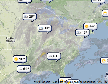
The weather mapplet for Google Maps enables users to add customizable weather layers to their map. Options include clouds and radar and points of interest, such as US and international cities and airports and US golf courses, lakes and schools. When selected, a bubble will appear at the point on the map with current weather conditions and temperature displayed. If there is severe weather for a point of interest, the bubble will be displayed in red with details of the alert.
The mapplet’s weather bubbles expand with a click to display HiRAD data for the point of interest including temperature, humidity, wind speed, and UV Index along with an observation of overhead sky conditions, which is unique to the HiRAD system. Forecast links including hourly, tomorrow, and 10-day are in the expanded bubble along with a link to a video forecast for the selected location. In addition, during severe tropical weather, users will see a Hurricane Central option on the mapplet that will enable them to track an active storm on the map.
Weather Layer on Google Earth
Current conditions in the Google Earth weather data layer are presented in a pop up window and include temperature, humidity, wind speed, pressure and dewpoint, along with an observation of overhead sky conditions. This is presented with forecast data including a 36 hour forecast and links to hour by hour and 10 day outlooks on weather.com. Also available are radar images on the map which are provided by weather.com and Weather Services International (WSI) via a product known as NOWrad.
“Adding HiRAD data from weather.com to Google Maps and Earth enables people to find the weather at the locations most important to them — schools, parks, golf courses and neighborhoods. No one else can make weather so personal and relevant,” said Joe Fiveash, executive vice president/general manager of TWCI.
