Wikinear is a simple application that lets users to locate Wikipedia entries for locations nearest to where a user is currently located. It was designed for mobile phones and it’s a good alternative to GPS navigation.
Utilizing several technologies from various geographic location tools, Wikinear mashed up these APIs in 200 lines of codes to display five Wikipedia pages nearest to a users location.
These five technologies are:
OAuth – to let users delegate permission to perform actions on their behalf, without handing over their authentication credentials to a third-party piece of software.
Fire Eagle – serves as a location broker that set the geographic location of a user and for retrieving the user’s location. Fire Eagle provides the tools that users can use to manage application that can access their location.
Wikipedia and GeoNames – Using an API, GeoNames query Wikipedia by location based on articles extracted from Wikipedia data dump.
Google Static Maps – By constructing a URL to the image, Statics maps can be dynamically generated on the fly. Displayed maps are optimized for mobile viewing .
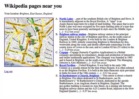
Wikinear seems to be a pretty useful application to learn about specific locations through its Wikipedia entries. Unfortunately, the site requires Fire Eagle which is currently on by-invitation beta mode only. You may sign up for Fire Eagle invitation and wait till you get a code. In the meantime, we may have to contend ourselves with this screenshot of the Wikinear in action.